Thyolo District (Thyolo District)
The Thyolo district of Malawi is one of the districts in Malawi. The capital is Thyolo. The district covers an area of 1,715 km.² and has a population of 458,976. It is also has crossroads leading to Makwasa, Molere, Konzalendo, Thekerani into Muona and eventually Nsanje leading to another border with Mozambique.
At the time of the 2018 Census of Malawi, the distribution of the population of Thyolo District by ethnic group was as follows:
* 77.2% Lomwe
* 12.3% Mang'anja
* 3.3% Ngoni
* 2.1% Yao
* 1.2% Sena
* 1.1% Chewa
* 0.3% Tumbuka
* 0.2% Nyanja
At the time of the 2018 Census of Malawi, the distribution of the population of Thyolo District by ethnic group was as follows:
* 77.2% Lomwe
* 12.3% Mang'anja
* 3.3% Ngoni
* 2.1% Yao
* 1.2% Sena
* 1.1% Chewa
* 0.3% Tumbuka
* 0.2% Nyanja
Map - Thyolo District (Thyolo District)
Map


Country - Malawi
 |
 |
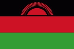
| Flag of Malawi | |
In 1891, the area was colonised by the British and became a protectorate of the United Kingdom known as Nyasaland. In 1953, it became a protectorate within the semi-independent Federation of Rhodesia and Nyasaland. The Federation was dissolved in 1963. In 1964, the protectorate was ended: Nyasaland became an independent country under Queen Elizabeth II, and was renamed Malawi. Two years later it became a republic. It gained full independence from the United Kingdom, and by 1970 had become a totalitarian one-party state under the presidency of Hastings Banda, who remained in this role until 1994. Malawi has a democratic, multi-party republic headed by an elected president. Lazarus Chakwera of the Malawi Congress Party led the Tonse Alliance grouping of nine political parties and won the court-mandated Presidential Election rerun held on 23 June 2020 after the May 2019 Presidential Election was annulled due to electoral irregularities. The country's military, the Malawian Defence Force, includes an army, a navy, and an air wing. Malawi's foreign policy is pro-Western. It maintains positive diplomatic relations with most countries, and participates in several international organisations, including the United Nations, the Commonwealth of Nations, the Southern African Development Community (SADC), the Common Market for Eastern and Southern Africa (COMESA), and the African Union (AU).
Currency / Language
| ISO | Currency | Symbol | Significant figures |
|---|---|---|---|
| MWK | Malawian kwacha | MK | 2 |
| ISO | Language |
|---|---|
| NY | Chichewa language |